Michigan traveling
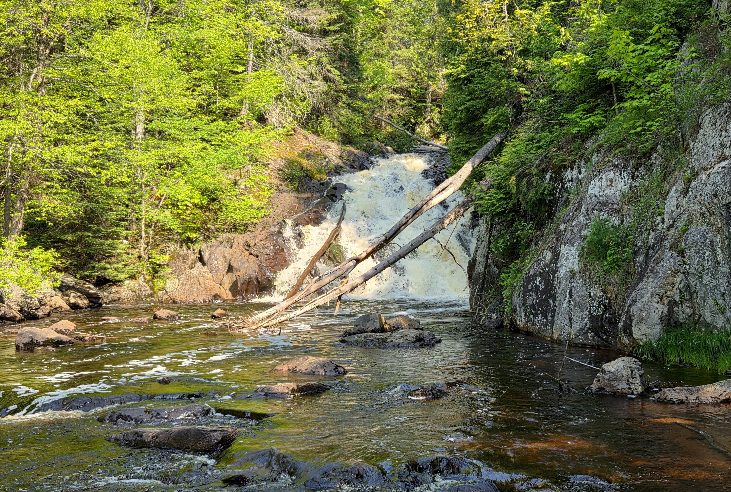
Marquette County is home to many beautiful waterfalls and seemingly endless outdoor recreation opportunities. Over the years we’ve had the chance to visit Yellow Dog Falls, Dead River Falls, Black River Falls, Alder Falls, Warner Falls, Morgan Falls, and more. We recently visited Pinnacle Falls for the first time while in the area in June, and today we will share how you can visit this wilderness waterfall. Getting to Pinnacle Falls requires a bit of driving on back roads and a short but mildly challenging downhill hike, but the views of this 25 foot drop on the Yellow Dog River are worth the effort to get there.

The drive to Pinnacle Falls from Marquette follows CR-550, CR-510, and AAA Road for about 30 miles before two miles of dirt roads bring you to the trailhead. We found there to be plenty of signs along the way and while we had Google Maps leading the way, we could have found this waterfall without it.

I had read that Pinnacle Falls used to be quite an adventure to get to, but with most of the drive to the trailhead being easy it seemed like this one wasn’t going to be as difficult to get to as I thought. I had also read that the trail to the falls was steep and demanding so we started the hike ready for that. After a short walk through the woods, the trail does make a steep descent but it was nothing too tough with a slow pace and a constant eye on the exposed tree roots. I would imagine that in spring or after recent rains this trail could be much more challenging.

Once we reached the bottom of the hill, a sign welcomed us to Pinnacle Falls on the Yellow Dog River. This area is a protected preserve and part of the Yellow Dog Watershed Preserve. You can read about the history of the area (including how there used to be a dam at the top of the falls used in a logging operation) and the mission of YDWP on their website. Staying on the main trail past this sign, we made another slight downhill before curving to the right past a large granite wall. A few hundred feet later we could see the river and it was easy to follow the path the rest of the way to a view of the falls.

It was great to finally reach Pinnacle Falls, and the view from the side of the river was impressive! Depending on water levels, it looked like it might be possible to wade out into the river or cross to the other side for even better views.

The hike back to the car was a bit more challenging as it was mostly uphill, but finally getting to Pinnacle Falls was worth the effort! Our total hiking distance for the visit was just over a mile. This video gives a short look at this beautiful wilderness waterfall in Marquette County:
Driving directions from Marquette: head north on CR-550 for a little over 22 miles, then turn left on CR-510. Follow CR-510 for another few miles and when it intersects with AAA Rd. continue straight to stay on AAA. Six miles later a large brown sign will direct you turn left down a dirt road. Follow this dirt road and stay to the right as it passes a truck depot. It is around two miles to the trailhead from this point and there will be signs (shown below) directing you the right way at any intersections.


Disclaimer: This story is auto-aggregated by a computer program and has not been created or edited by Worldtravelers.
Publisher: Source link
Publisher: Source link

Latest Posts
-
 31 July 2025
 -
 26 July 2025
 -
 14 July 2025
 -
 01 July 2025
 -
 07 August 2025
 -
 29 July 2025
 -
 20 February 2025
 -
 04 February 2025
Get The Best Blog Stories into Your icountox!
Sign up for free and be the first to get notified about new posts.