Michigan traveling

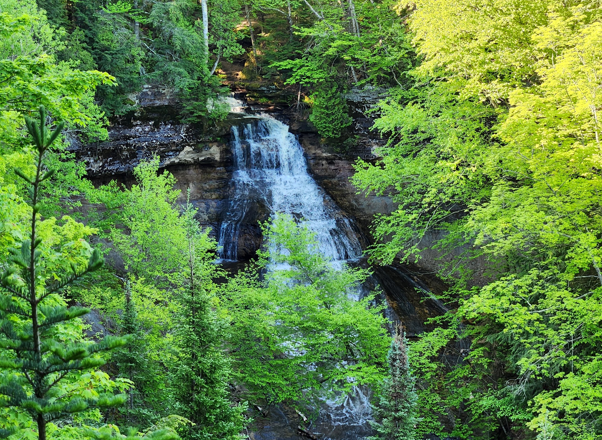
Pictured Rocks National Lakeshore is one of the Upper Peninsula’s top destinations, and each year hundreds of thousands visit to see the colorful sandstone cliffs, hike the miles of trails, relax at the beaches, learn about history, and see waterfalls. One of the waterfalls at this park is Chapel Falls, a stunning 60 foot drop of Chapel Creek as it fans out over an angled sandstone cliff. The hike back to this waterfall is a fairly easy one, covering a little more than a mile each way. We recently had a chance to visit this waterfall again and today we will be sharing our experience on the hike and some photos and video from Chapel Falls!

The hike to Chapel Falls begins from the same parking lot as the one for Mosquito Falls, Chapel Rock, and the Lakeshore Trail. This parking lot is located roughly 19 miles east of Munising and involves driving the final five miles on a dirt road (directions at bottom of post). The parking lot here can fill up quickly on summer days, so get there early!

The trail begins as a flat and quiet walk through some beautiful woods. We heard lots of birds and saw many chipmunks. It takes a hike of 1.2 miles to reach Chapel Falls, so we kept a steady but relaxing pace. With an earlier departure we had the trail mostly to ourselves.

Hitting the trail in spring or early summer will also have the forest floor covered in green. Ferns and other plants and flowers cover the landscape. There is one uphill section before the falls, and you will see some exposed sandstone that almost forms natural steps.

Once you can hear the falls the fun begins. The first spot you will come to offers a view of the top of the falls from the side.

The trail continues on and you will want to head left across the bridge that crosses the creek. Just below this bridge is a small but scenic section of falls.

A few well-worn trails lead close to the brink of the falls. Use caution here as there are no fences or railing, but some great views can be had from a safe distance. The trail continues on for a few hundred feet as it follows the cliff edge around to the other side for straight-on views of Chapel Falls. Below is a short video showing what the final part of the hike looks like:
It is hard to photograph all of Chapel Falls once the trees have their leaves. The view from the viewing platform is still pretty great and there are options to continue on from here if you wish to explore the North Country Trail or Chapel Rock and other lakeshore features.

This is one of the more remote waterfalls within Pictured Rocks National Lakeshore. The round trip hike of 2.4 miles offers some beautiful scenery and lots of wildlife and plants to check out. It was awesome to have a chance to get back to Chapel Falls this year and we look forward to hiking there again soon!

To get to the trailhead parking area, head east out of Munising on H-58 and follow it for about 15 miles then turn left onto Chapel Dr. (following the Pictured Rocks signs). Follow this dirt road for roughly five miles to the parking area. Signs in the parking lot will direct you to the trails for both Chapel Falls and Mosquito Falls.
Disclaimer: This story is auto-aggregated by a computer program and has not been created or edited by Worldtravelers.
Publisher: Source link
Publisher: Source link

Latest Posts
-
 31 July 2025
 -
 26 July 2025
 -
 14 July 2025
 -
 01 July 2025
 -
 07 August 2025
 -
 29 July 2025
 -
 20 February 2025
 -
 04 February 2025
Get The Best Blog Stories into Your icountox!
Sign up for free and be the first to get notified about new posts.