
Try This Quiz on the Locations of These Novels Set in America’s Old West

Michigan traveling
Michigan Trail Tuesday is our attempt to showcase a different trail or trail segment each week. The Mitten State is home to thousands of miles of trails, including the new Iron Belle Trail that runs from Detroit in the southeast to Ironwood in the western Upper Peninsula and more miles of the North Country Trail than any other state.
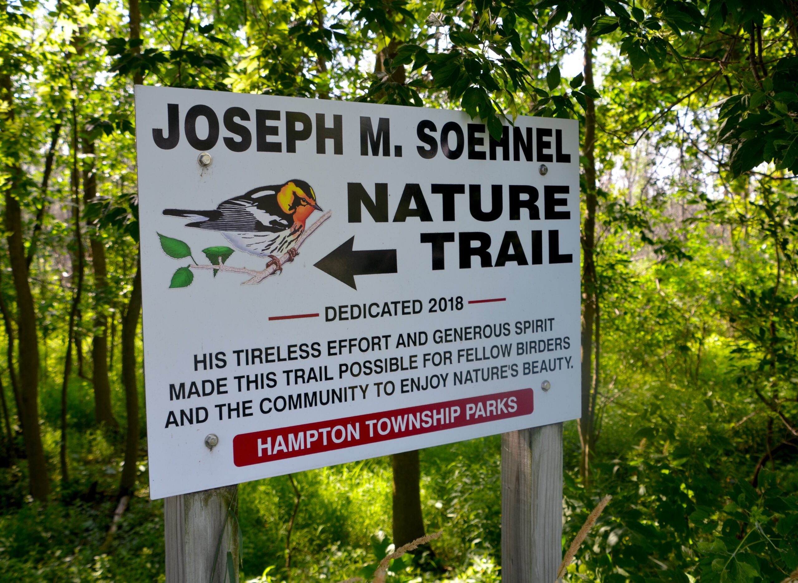
We were in Bay County this July looking for places to hike and see wildlife when we stumbled across the Joseph M. Soehnel Nature Trail. This flat, well-maintained hiking trail passes through wetlands and woods as you watch for birds and other wildlife here in the Quanicassee Wildlife Area.
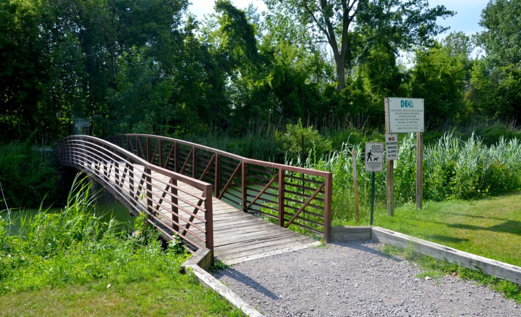
We parked near the boat launch at the end of Finn Rd., across from a playground and the campground. A small footbridge leads over a water-filled ditch. From here we went left and then made a right as the path widened. This gravel path is flanked on both sides by wetlands, and you’ll hear the songs of birds almost immediately. Our visit fell on a very hot day, so we kept moving forward and hoping for a breeze or a more wooded stretch of path.
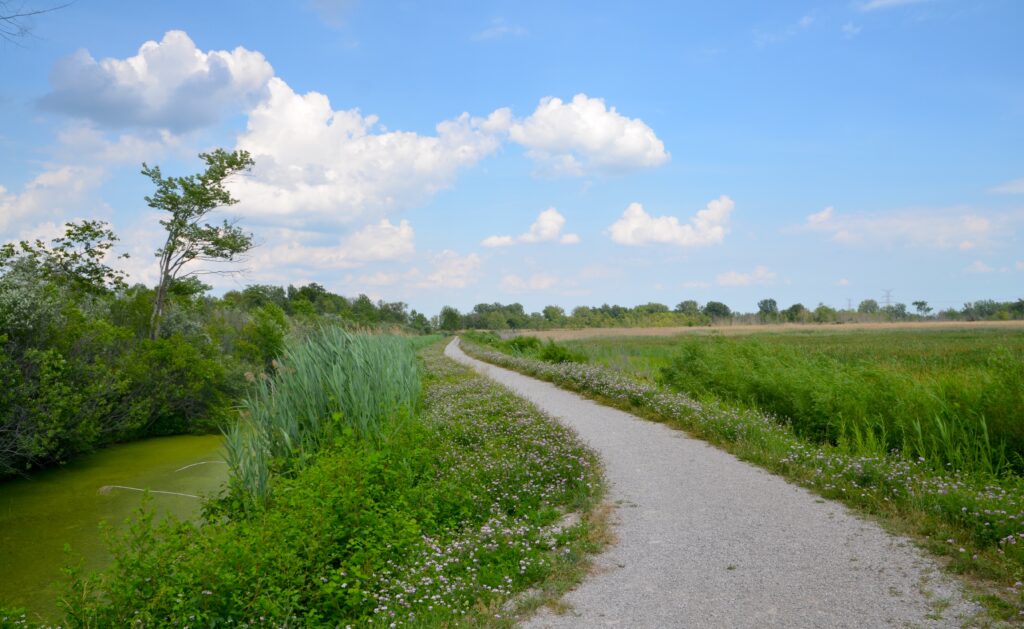
The path makes a right turn around a quarter mile in, and at this point the views to the left really open up across a wetland that is home to turtles, snakes, frogs, birds, and small mammals. After another quarter mile the trail heads left and continues to have great wildlife viewing chances on both sides. Egrets, herons, red-winged blackbirds, and more frequent this area.
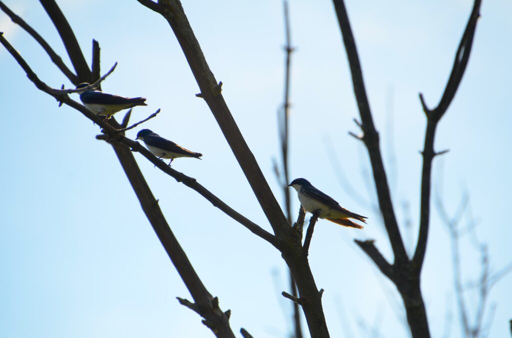
When the path then heads to the right you will start to see more trees and finally get a little bit of shade. We saw quite a few swallows and sparrows on the branches here. The trail continues into the woods and the trees get taller as you work your way to the other end of the trail at Knight Rd. There is a bench here for resting and reflection, and a memorial stone for Joseph M. Soehnel that notes how he made this trail possible so other birders and community members could enjoy this beautiful piece of property.
To reach the parking area for the Soehnel Nature Trail, head north on Finn Rd. from M-25 (east of Essexville) and follow it for just over two miles. You will see the campground on the right and the boat launch straight ahead, the parking lot has many spots and the pedestrian bridge marks the start of your hike.
Disclaimer: This story is auto-aggregated by a computer program and has not been created or edited by Worldtravelers.
Publisher: Source link
Publisher: Source link

Latest Posts
-
 31 July 2025
 -
 26 July 2025
 -
 14 July 2025
 -
 01 July 2025
 -
 07 August 2025
 -
 29 July 2025
 -
 20 February 2025
 -
 04 February 2025
Get The Best Blog Stories into Your icountox!
Sign up for free and be the first to get notified about new posts.